
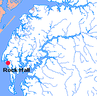
Rock Hall
Driving Directions
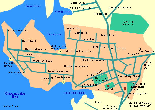
Driving Through Rock Hall
Enter Rock Hall on Route 20. Before turning left at the blinking light onto Main Street, notice the statue of the waterman and the restored waterman's shanty on the right; they pay tribute to the town's enduring heritage as a major fishing and oystering port on the upper Chesapeake Bay.
If you have time, park on Main Street for a while and visit Durding's Store, a carefully restored turn-of-the-century soda fountain and ice cream parlor at the southern end of the street. Opposite Durding's Store, you'll see the America's Cup Cafe and just down the block, The Mainstay, a center for the visual and performing arts. Behind the Mainstay are the Shoppes in Oyster Court. For a more detailed map of the shopping, dining and other opportunities available in the downtown area, click here.
Return to your car and travel south on Route 445 for 6 miles to the Eastern Neck National Wildlife Refuge. There are some well-maintained trails for walking, and the refuge is a stopping place for hundreds of species of migratory birds in the fall and spring of each year. It is also a nesting area for Bald Eagle and Osprey. The Refuge Office and Shop are located on the Bay side of the island about 2 miles beyond the entrance. As you return to Rock Hall, make a left onto Green Lane just outside of town for a look at Rock Hall Harbor from the Bay side. Back on Route 445 N, you will see the Rock Hall Municipal Building on your right which houses the town's Public Library and a small museum with displays which help to explain local history and legend.
Continue north on Route 445 and turn left onto Chesapeake Avenue. Bear right around Rock Hall Landing, then take the first left onto Bayside Avenue, then left again onto Caroline Avenue. This will bring you to the ![]() County-owned bulkhead at the foot of Rock Hall harbor where many watermen still work. Return to Bayside Avenue and follow it around the northern edge of the harbor, taking the second left onto Beach Road. There is a spectacular panorama of the Chesapeake Bay from
County-owned bulkhead at the foot of Rock Hall harbor where many watermen still work. Return to Bayside Avenue and follow it around the northern edge of the harbor, taking the second left onto Beach Road. There is a spectacular panorama of the Chesapeake Bay from ![]() Rock Hall Beach.
Rock Hall Beach.
Continue on Beach Road to Rock Hall Avenue and make a right. The ![]() Waterman's Museum is about 1/4 mile down on the left. It features a fishing shanty and artifacts from the early days of crabbing, fishing and oystering, as well as photographic documentaries of past and present watermen.
Waterman's Museum is about 1/4 mile down on the left. It features a fishing shanty and artifacts from the early days of crabbing, fishing and oystering, as well as photographic documentaries of past and present watermen.
Driving Tours in Kent County